


The Growing Importance of Geospatial Data Services in Modern Industries
Unlock insights with geospatial data services. Accurate mapping, analysis, and visualization for smarter decisions in diverse industries.

In todays digitally interconnected world, the way industries harness data has fundamentally transformed the decision-making process. One of the most impactful and rapidly expanding areas of this transformation isgeospatial data services. These services, which deal with the collection, analysis, and interpretation of location-based data, are becoming indispensable across a wide spectrum of industries from urban planning and agriculture to logistics, defense, and environmental management. As this spatial intelligence converges with technologies such as artificial intelligence, satellite imaging, and video annotation services, a new era of precision, efficiency, and insight is emerging.
Understanding Geospatial Data Services
At its core, geospatial data refers to information that has a geographic component, meaning it is associated with a specific location on the earths surface. Geospatial data services involve acquiring, processing, managing, and analyzing this data to support decision-making. Sources of such data can include GPS systems, satellites, remote sensors, drones, mobile devices, and geographic information systems (GIS).
These services don't just answer the question of where they provide critical context, such as how a place has changed over time, whats happening in real time, and how future scenarios may unfold based on predictive modeling. The ability to analyze spatial patterns and trends gives businesses and governments the intelligence they need to plan, respond, and innovate effectively.
Transforming Industries Through Location Intelligence
Geospatial data services have far-reaching applications that extend into nearly every modern industry.
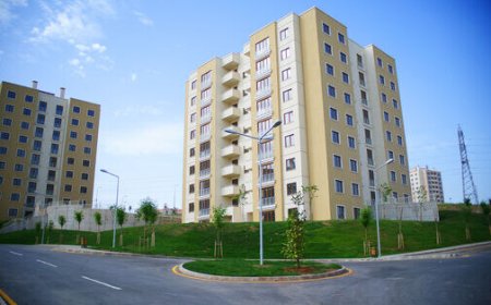
In urban planning, city officials use geospatial data to design smarter infrastructure, monitor traffic patterns, and improve public transportation systems. With this information, cities can optimize land use, predict growth areas, and reduce congestion leading to more livable and sustainable environments.
Agriculture has also been profoundly impacted. Precision farming techniques rely on satellite imagery and geospatial analytics to monitor crop health, soil moisture, and pest movement. Farmers can make data-driven decisions about irrigation, fertilization, and harvesting schedules, improving yield and conserving resources.
In the logistics and supply chain sector, geospatial services enable real-time fleet tracking, route optimization, and predictive delivery management. These capabilities not only cut down costs but also improve customer satisfaction by ensuring faster and more reliable deliveries.
Disaster response and environmental monitoring benefit immensely as well. Geospatial tools help track forest fires, monitor flood zones, assess damage from earthquakes or hurricanes, and even analyze climate change patterns. Authorities can respond more quickly and accurately when they have access to timely and location-specific data.
Even the defense and security sectors rely heavily on geospatial intelligence for surveillance, reconnaissance, and mission planning. Accurate geospatial data allows for better situational awareness and faster, more informed responses in complex scenarios.
The Role of Video Annotation Services in Enhancing Geospatial Data
While static maps and satellite images have long been used in geospatial analysis, the growing volume of dynamic video datacaptured by drones, security cameras, and satelliteshas introduced a new layer of complexity and potential. To make sense of this data, video annotation services have become essential.
Video annotation involves labeling objects, actions, and environments within video frames to make the content understandable to machine learning algorithms. When applied in a geospatial context, this means annotating visual data with spatial relevance identifying moving vehicles, tracking pedestrian behavior, or marking changes in vegetation across seasons or years.
For instance, in traffic analysis, video annotation services can be used to track vehicle density in specific regions over time, helping transportation departments make data-backed infrastructure investments. In environmental studies, drone footage can be annotated to monitor deforestation, track wildlife populations, or assess urban sprawl.
This integration of annotated video with geospatial data amplifies the value of both. Machine learning models trained on such enriched datasets can detect patterns and make predictions with greater accuracy, transforming raw data into actionable insights.
Scaling Smart Solutions with AI and Automation
The vast amount of geospatial and video data being generated today would be impossible to analyze manually. This is where AI-powered automation becomes a vital component of geospatial data services. Artificial intelligence enables the classification, segmentation, and interpretation of massive datasets in real time, turning visual and spatial information into high-precision intelligence.
Video annotation services serve as the foundational training step in this process. Without well-annotated data, AI models cannot effectively "learn" to recognize relevant spatial patterns. Annotated datasets ensure that the AI systems are not only functional but reliable when deployed in real-world settings, whether for autonomous vehicle navigation, infrastructure monitoring, or agricultural forecasting.
Conclusion
The importance of geospatial data services in modern industries cannot be overstated. As the world moves toward more interconnected systems and data-informed strategies, geospatial intelligence is becoming a core driver of innovation and operational efficiency. When combined with video annotation services, these tools dont just tell us where things are they reveal whats happening, why it matters, and what to do next.
In a landscape defined by constant change, location-aware data and intelligent visual interpretation offer the clarity and confidence industries need to move forward. Through strategic use of these services, businesses and governments alike can make better decisions, respond more swiftly to evolving needs, and ultimately, build a smarter, safer, and more sustainable world.